King City is moving right along with its Kingston Terrace Master Plan for the 528 acres within its urban growth boundary located between the western boundary of the city, the Tualatin River and Beef Bend and Roy Rogers roads.
Since Metro approved King City’s UGB expansion just over four years ago, city officials and planning consultants have made steady progress on coming up with a framework to deal with the area’s natural topography while planning for transportation routes, 3,300 to 3,600 housing units of different types, park and recreation opportunities, infrastructure and financing.
The most controversial aspect has been the Transportation System Plan that emphasizes potential east-west connections, which some residents in the UGB say will divide established neighborhoods and greatly increase traffic on existing streets in King City.
The city’s TSP is scheduled to be adopted by June, with the Kingston Terrace Master Plan scheduled to be adopted by July.
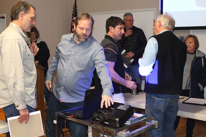
City officials have held numerous public meetings over the years to gather input from residents, and they held another public meeting Feb. 8 in the King City Civic Association Clubhouse, which drew about 100 people.
Representing the city were City Manager Mike Weston, city planning consultant Keith Liden, Steve Faust with 3J Consulting and Marcy McInelly with Urbsworks.
“King City has adopted House Bill 2001, which has new rules for master planned communities,” Faust said at the beginning of the meeting. “There must be 20 dwelling units per net acre, and 318 out of the 528 acres in the UGB can be developed.”
The area’s future town center along Roy Rogers Road will have denser mixed-use housing with municipal uses, while the remainder of the land is divided into three different neighborhood areas that will have neighborhood parks in each plus two community parks area-wide.
About 20 people at the meeting asked questions or made comments that ranged from one threatening to recall the city councilors to another one saying he is not against “sensible” growth.
One of the biggest controversies concerning the TSP is a projected street through the 12.82-acre Bankston property, which is in a Columbia Land Trust conservation easement. A man representing the trust pointed out that “there are alternatives to ignore the easement altogether.”
Dave Robinson told the planners that “99 percent of us here don’t want the Transportation System Plan.”
A woman who grew up in the area said, “My home appears as a traffic circle on your map.”
Susan Meyer, whose husband’s family has lived on riverfront land in the UGB for generations, said, “Your traffic counts are not taking into effect River Terrace,” which is Tigard’s development on the south side of Bull Mountain that will provide housing for approximately 6,500 new residents at build-out.
Her husband Mike Meyer asked about the 600 feet between major streets showing on the map throughout the area, noting that they looked busier in the center. Faust responded that the goal is to spread out the traffic, and Weston added, “When developers come in, they will determine the exact location of the streets.”
Gregg Russell, who lives in a historic community called Rivermeade on the Tualatin River, said, “Beef Bend is overloaded now. We already have to wait at the light to pull out on 99W from Beef Bend Road.”
Weston explained that the transportation system will be developed slowly over many years, such as the Tier 1 phase in one to seven years, the Tier 2 phase in seven to 14 years, and so on, but he added, “It could possibly be moved up if we see developers move faster, or if we see less development, the roads would be developed slower. We wouldn’t punch through roads for construction traffic.”
In response to her question, a woman was told that there are three or four planned routes to connect “old” King City (Edgewater) with “new” King City, including Montague Way, Capulet Lane and Fischer Road.
A resident of Edgewater asked, “My biggest concern is safety. What are you going to do to make Fischer safe? I walk it all the time now. It is a legitimate concern. Since you’re all set on this, can you make it enjoyable to walk with additional people using it?”
Weston replied, “It will take inter-agency coordination. Fischer is an arterial street maintained by Washington County.”
A woman who lives in Rivermeade said, “Edgewater is going to bear the brunt of the increased traffic. Why should people who will be buying a house (in the new area) dictate what happens to them?”
A man added, “It’s pretty clear what people want, and the City Council is not listening.”
The King City Planning Commission was scheduled to hold a workshop meeting Feb. 15 to discuss the TSP and the Kingston Terrace Master Plan.
For more information, check out the city’s website at ci.king-city.or.us.


